CESARE Portal
Insights
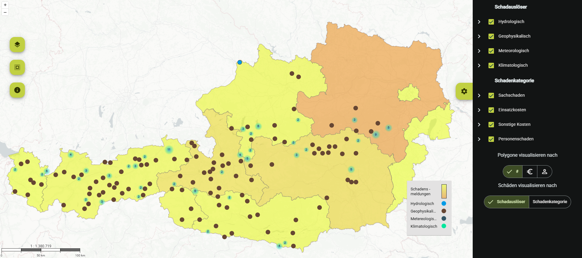
The CESARE Portal combines the harmonized damage and events from the database in a Web GIS portal. It offers the option of temporal and/or geographical aggregation, various filters, statistical analysis functions, and different visualizations. The data can be selected and evaluated by date, hazard type, and affected element. In addition, a preselection of individual events based on frequently searched disasters is available.
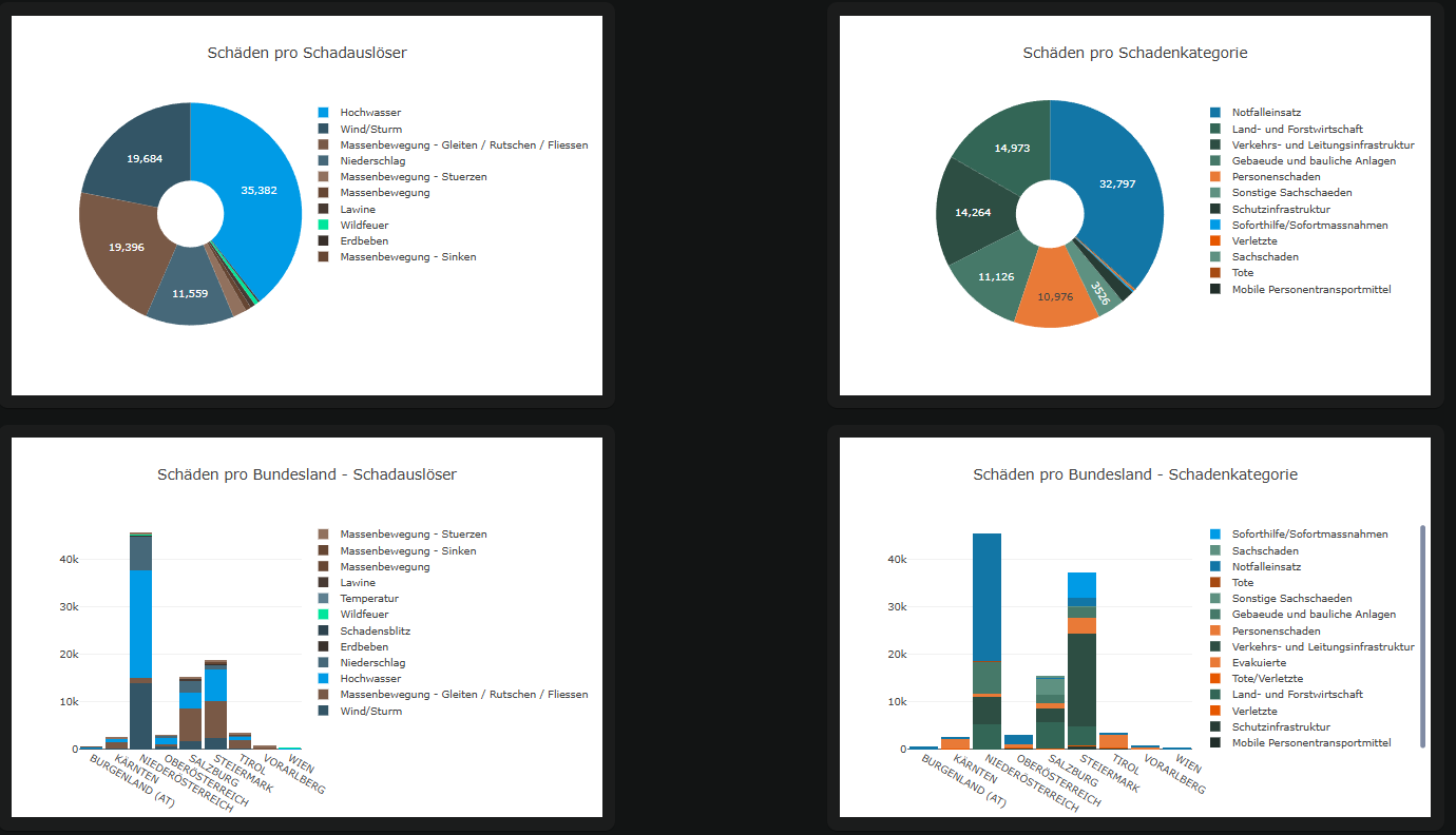
In addition, dashboards are available that provide more detailed information on how losses and damage amounts are distributed across assets, hazards, and administrative areas. Furthermore, the losses and damages are compared with the SENDAI indicators for global targets A, B, and C, and the trends over time for the respective losses and damages are displayed.
Likewise, detailed reports with analyses of the data included in CESARE are provided for individual events as well as for specific years.
Access
The portal is a closed, password-protected system that can be made accessible to stakeholders. To apply for access, please contact us.
Background
The demonstrator from the FFG/KIRAS CESARE project was revised in the follow-up project CESARE+PLUS and transferred to an operational system.
The design, development, and implementation of this system was developed through requirements analyses, user workshops, and additional surveys (reporting, access rights, and integration of additional data) and is being continuously expanded.